Some gravel they didn't find
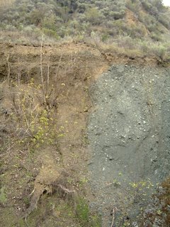
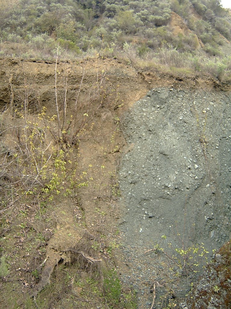
The Gravel Pit was no doubt abandoned when they'd extracted all the gravel that was economical to extract. However, a natural fissure in the ground which has been enlarged by erosion has opened up a canyon to the northeastern end of the valley. Here in the canyon wall you can clearly see a seem of gravel that the miners missed. To the left you can see the red clay, but to the right, under a thin layer of red clay topsoil you can see gravel buried in gray clay.
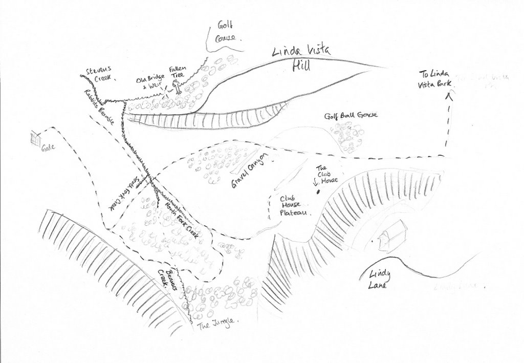
Mapping It
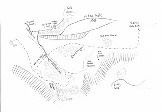
Like all good secret gardens there's got to be a map. So I made one. As you can see I've also had fun naming places. This is a work in progress.
Stevens Creek in flood

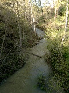
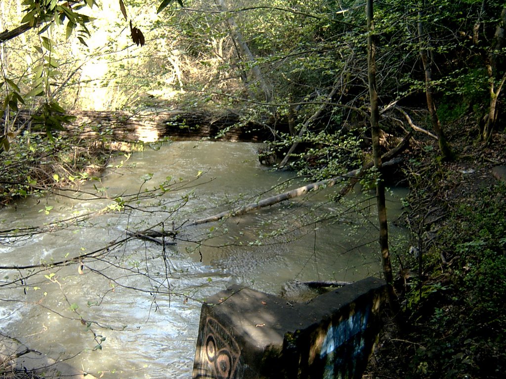
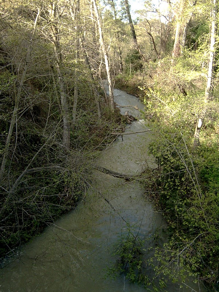
Today I decided to trace the stream that runs through the Gravel Pit to where it flows into Stevens Creek. After all the rains of the last few days all the streams were in flood (photo left), and it was it quite a sight to see. On following a narrow track along the north side of the stream it dropped to a clearing bordering Stevens Creek. Large concrete blocks on either side of the river suggested that this may have been the location of the bridge the quarry owners built and used half a century ago. A large tree had fallen across the river a hundred yards downstream providing an natural bridge for the daring (top photo)!
Lindy Lane and Regnart Road
Last weekend I took a drive around Lindy Lane and Regnart Road. Unfortunately the section of Lindy Lane that overlooks the Gravel Pit is a private road. There are some beautiful houses up there with beautiful views.
Apparently the Gravel Pit is currently privately owned by a man who wants to build a Christian school there. He's been trying for many years but can't get the land zoned for a school. I remember a few years back seeing a neighborhood flyer campaigning against plans for a Christian school near the Stevens Creek Reservoir - this must be the same one. The biggest issue then seemed to be access. The problem with the Gravel Pit is that it can only be entered from the west. This means an access road would need to be opened up from Stevens Canyon Road with a bridge across Stevens Creek, which would probably mean connecting in to the Rancho Deep Cliff estate, and that would not be popular with the residents. Historically, access to the gravel pit was through Mirramonte Road, but that is now an up-market cul-de-sac, and it's hard to imagine how that might be opened up again.
So for the last 50 years the Gravel Pit has been unused, waiting for an appropriate development opportuity. I understand that it is now zoned for housing. But access would still be a big issue for any potential developer. For now, it's one big secret garden.
The History of Stevens Creek Reservoir, the Dam and the Gravel Pit
Stevens Creek was originally known as Arroyo de San José Cupertino. But the stream is now named after, Captain Elishia Stephens, a South Carolinian, who led the first successful passage of wagons over the Sierra Nevada in 1844. The dam and reservoir were completed in 1935.
Quarrying for gravel originally began on the Linda Vista side, but by 1961 they were quarrying in the valley that I've been referring to as the Gavel Pit. Access was from Stevens Canyon Road and bridge across the Creek at the western entrance to the valley completed the route into the canyon.