The Stevens & Permanente Creeks Watershed Council
It seems that the Stevens & Permanente Creeks Watershed Council (
http://www.spcwc.org/ ) have something to do with the Gravel Pit. I've posted some of my photos in their public photo albums.
So what does it look like?
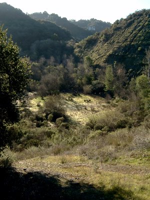
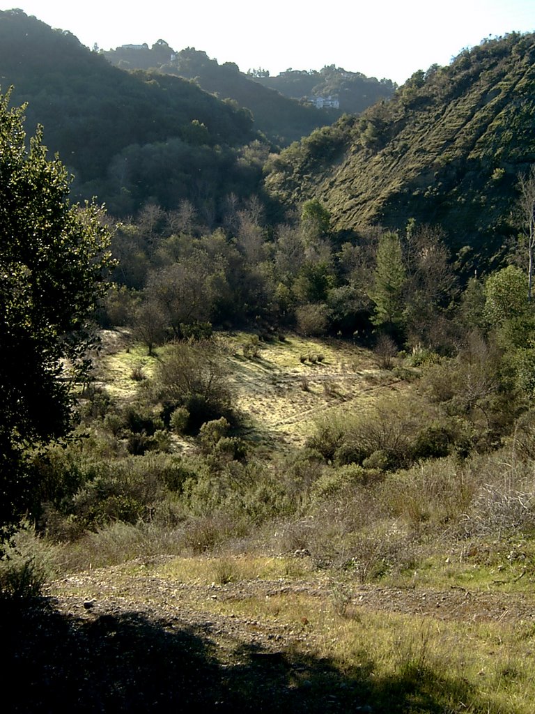
Here's the view of the valley from the new entrance from Villa Maria looking southeast. The valley bottom is mostly flat and open, but rather boggy during the winter. Even during the summer it remains damp under foot. This supports the theory that this once was a gravel pit since gravel is typically found where the water table is high, and often disused gravel pits get made into small lakes.
So where is it exactly? The valley is in Cupertino, California - in the heart of Silicon Valley. But to be honest it's hard to describe its exact location, and I'm not too sure I want to. There is no street access, no parking lot, no adjacent facilities. It is bounded on 3 sides by cliffs, and on the north side by Stevens Creek itself, which for this short length is actually running east-west. The valley is just south of Linda Vista Park in Cupertino, southeast of Deep Cliff golf course in Cupertino, and northwest of Lindy Lane (though Lindy Lane is at a much higher elevation).
The next question is who owns this place? I suspect it is either still owned by the mining company (would that be Hanson Permanente Cement?) or possibly the San Jose Water Company since this might be considered a watershed. Either way, apart from the fence, no is doing much to place their stamp of ownership on the place - which is a good thing!
Discovering the Gravel Pit
A couple of years ago I followed a path from the lower parking lot in Stevens Creeek County Park along the south side of the creek. It eventually emerged into an open valley surrounded on three sides with steep cliffs. It seemed wild and overgrown - and largely untouched for many years. This valley has had a fascination for me ever since.
Just weeks after discovering a fence appeared right across the path from the County Park preventing entry so I stopped visiting the valley. However, just recently I discovered a second path from the north of the "Villa Maria" parking lot and picnic area that leads to the fence. But for the moment at least there is gate which is left wide open. So I have had opportunity to reenter the valley many times since.
What fscinates me and puzzled me about this valley is its unspoilt nature. There are narrow paths throughout the valley, but no attempts to perserve, maintain or "beautify" the area. And in all my visits I have seen only two young boys exploring as I was.
There are no sign boards saying who owns the place; and look at current maps gave no clues. So I took a look at historical maps and discovered that it in the 1950's until recently it was known as "The Gravel Pit". I conclude from this that there once was an open cast gravel mining operation here, and looking at the shape and layout of the land I can believe it.